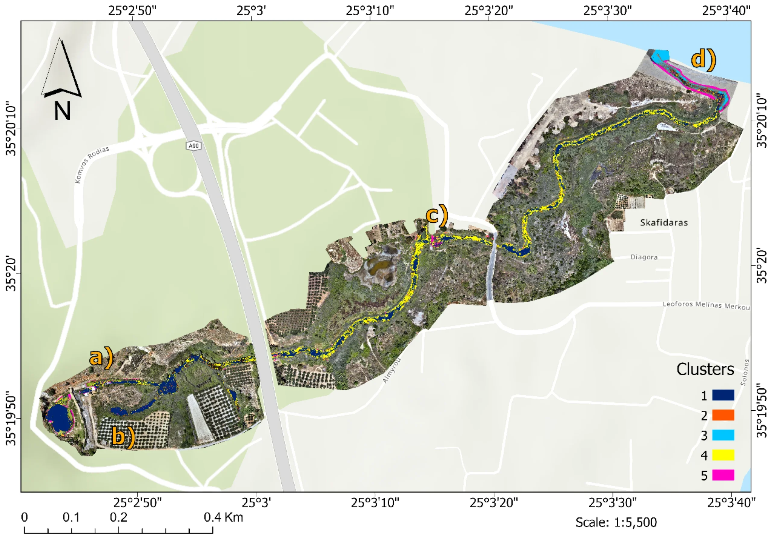
We are proud to announce that our Msc alumna Matenia Karagiannidou, has published her MSc thesis research as a peer-reviewed article in the Remote Sensing journal (MDPI) entitled “High-Resolution Eutrophication Mapping Using Multispectral UAV Imagery and Unsupervised Classification: Assessment in the Almyros Stream (Crete, Greece)”.
In this work, Matenia and co-authors present an innovative approach combining UAV (drone) multispectral imagery with unsupervised classification techniques to assess environmental conditions in the Almyros stream in Crete. The study demonstrates how high-resolution remote sensing can be used to map indicators of water quality and eutrophication — a critical step toward effective monitoring and management of freshwater ecosystems. This publication highlights the power of integrating remote sensing technologies and advanced data analysis to address real-world environmental challenges, and it underscores the impactful research being conducted by our alumni.
You can read the full open access article here: https://www.mdpi.com/2072-4292/18/3/501