
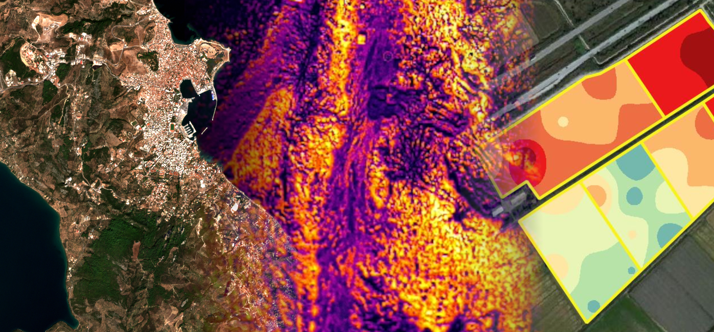
Mapping the Future: Innovating Earth Insights with Remote Sensing & GIS
Welcome to the webpage of the Remote Sensing and Geographic Information Science (RSGIS) Research Group at the Department of Geography, University of the Aegean. Our newly established team focuses on harnessing remote sensing and GIS technologies to address geographic challenges through cutting-edge applications. A core aspect of our work lies in integrating artificial intelligence (AI) and machine learning (ML) to develop innovative solutions for spatial analysis, environmental monitoring, and urban planning. We are committed to advancing research, fostering collaboration, and inspiring excellence in the application of AI-driven techniques to geographic information science. Join us in exploring the future of geospatial innovation.
News
- Participation in the FIRE-RES Final Conference, Brussels, 4–5 November 2025
 Our RSGIS research group participated in the final conference of the Horizon 2020 project FIRE-RES, titled “Toward a Wildfire-Resilient Europe: From Knowledge to Policy Action”, held on 4–5 November 2025 in Brussels. Asst. Prof. Christos Vasilakos represented our group at… Read more: Participation in the FIRE-RES Final Conference, Brussels, 4–5 November 2025
 - RSGIS Research Group @ the 9th Symposium of Archaeometry of the Hellenic Society for Archaeometry
 Our team member Asvestas Alexandros presented his MSc research at the 9th Symposium of the Hellenic Society for Archaeometry (HSA). Under the theme “Materializing the Past: Narratives via Archaeological Science”, the Symposium focuses on the cultural heritage of Greece, the… Read more: RSGIS Research Group @ the 9th Symposium of Archaeometry of the Hellenic Society for Archaeometry
 - RSGIS Research Group @ the Scientific Event on Wildfires in Chios
 Assistant Professor Christos Vasilakos participated in the scientific event titled “Wildfires in Chios: The University of the Aegean stands present for a better future”, organized by the University of the Aegean on Wednesday, October 15. The event was held in… Read more: RSGIS Research Group @ the Scientific Event on Wildfires in Chios
 - RSGIS Research Group @ IDRiM2025
 Assistant Professor Christos Vasilakos participated in the 15th International Conference of the Integrated Disaster Risk Management (IDRiM) Society (IDRiM2025), titled “Advancing Disaster Risk Reduction in Islands and Remote Areas.” The conference emphasized the distinct risk environments and complex challenges faced… Read more: RSGIS Research Group @ IDRiM2025
 - RSGIS Research Group at MEDNIGHT 2025!
 The Remote Sensing and Geographic Information Science (RSGIS) Research Group of the Department of Geography, University of the Aegean proudly participated in the Mediterranean Researchers’ Night – MEDNIGHT 2025! In the morning, we welcomed six school classes from across Lesvos… Read more: RSGIS Research Group at MEDNIGHT 2025!
 - Save the Date: MEDNIGHT 2025 – 26 September at Sapfous Square
 Our team is thrilled to announce that we will be participating in MEDNIGHT 2025, taking place at Sapfous square, Mytilene, on 26 September 2025, 18:00-21:00! We’re coming fully prepared to share our work and connect with everyone: Program is here.… Read more: Save the Date: MEDNIGHT 2025 – 26 September at Sapfous Square