Members of our group have contributed to the following research projects, funded by national and international organizations.

FIRE-RES pioneers innovative strategies to tackle Extreme Wildfire Events by addressing root causes and promoting preventive landscape and community management, building resilience for a safer and sustainable future.
Duration: 2021-ongoing
Funding: European Horizon 2020
The e-Aegean Communities unites the expertise of the University of the Aegean to drive research, spark innovation, enhance knowledge sharing, and inspire the next generation of researchers in the workforce.
Duration: 2021-2023
Funding: European Regional Development Fund and the Greek State
AEGIS+ aims to drive sustainable development and environmental protection in the Aegean islands, position the North Aegean as a hub for research and education, and deliver innovative tools and services to support climate adaptation efforts.
Duration: 2021-2023
Funding: European Regional Development Fund and the Greek State

Through the e-Aegean CulTour infrastructure, the University of the Aegean advances regional innovation by protecting cultural heritage, enhancing tourism and cultural skills, and fostering sustainable development through academic and community collaboration.
Duration: 2021-2023
Funding: European Regional Development Fund and the Greek State
AEGIS is a user-friendly Web-GIS platform designed for wildfire prevention and management in Greece, offering tools for early fire warning, planning, and firefighting coordination through seamless online access to critical information.
Duration: 2013-2015
Funding: European Union (European Social Fund) and the Greek State
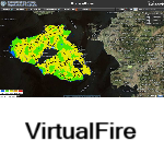
Virtual Fire is a standalone, web-based early warning and decision support system for forest fire management, providing firefighting teams with immediate and user-friendly access to critical geographical and relational data without requiring advanced GIS expertise.
Duration: 2009-2010
Funding: Microsoft Research

The Land SAF aims to maximize the benefits of MSG and EPS satellite data by developing advanced techniques, products, and algorithms for land, land-atmosphere interactions, and biophysical applications, enhancing their effective use.
Duration: 2000
Funding: EUMETSAT
The THEMA project aimed to analyze surface reflection and emission data from the Daedalus ATM airborne sensor, drawing insights on hot/cold areas and temperature gradients along key fresh air paths in Athens and Thessaloniki.
Duration: 2000-2001
Funding: Greek General Secretariat for Research and Technology

ATHOS project aims to study how vegetation is shaped by the environment, the frequency of wildfires in each area, and the extent of human presence and activity. Different types of vegetation and wildfire occurrences were analyzed using geoinformatics technology.
Duration: 1999-2000
Funding: National Agricultural Research Foundation


